Arctic Blast Grips Indianapolis: Dangerous Wind Chills and Icy Commutes Expected Today
Arctic Blast Grips Indianapolis: Bitter Cold and Icy Commutes Define Today’s Forecast
Residents of Indianapolis are waking up to some of the harshest conditions of the winter season this Friday, January 30, 2026. An Arctic air mass has firmly entrenched itself over Central Indiana, bringing dangerously low temperatures and significant travel hazards for the morning commute. Local authorities are urging caution as the combination of subzero wind chills and slick road surfaces creates a challenging environment for the Circle City.
Morning: Dangerous Wind Chills and Black Ice
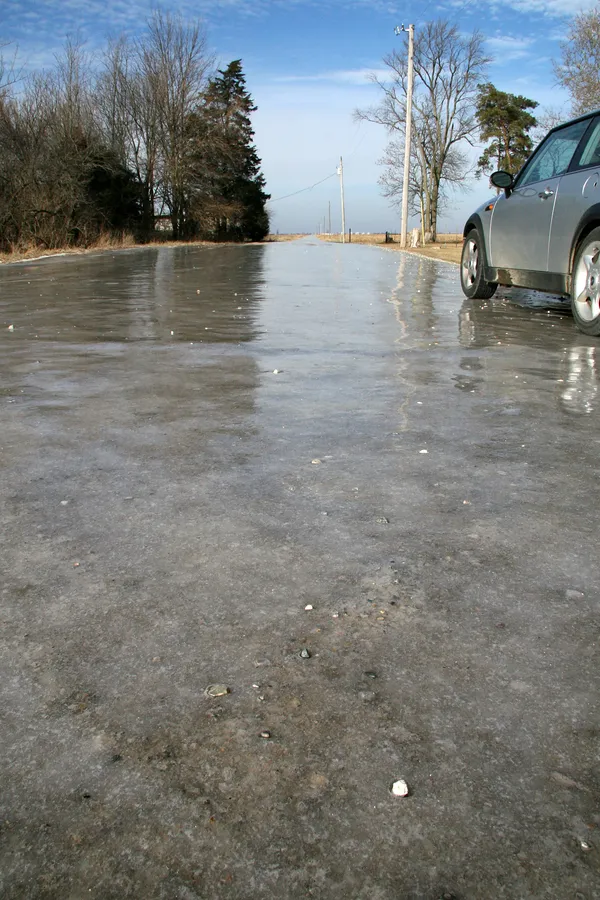
The morning hours are the most critical period for those heading outdoors. The National Weather Service has highlighted a significant risk of hazardous wind chills, which are expected to range between -10 and -20 degrees Fahrenheit during the early commute. While the actual air temperature starts near the low single digits, a steady breeze from the north-northeast at roughly 8 to 10 mph will make conditions feel significantly more brutal. Additionally, meteorologists are warning of "black ice" on area roadways. Despite the absence of heavy active snowfall this morning, the extreme cold has caused lingering moisture on pavement to refreeze, creating invisible slick spots that may catch drivers off guard on highway overpasses and side streets.
Afternoon: Persistent Cold Under Partly Sunny Skies
Expect some sunshine to break through during the afternoon, though it will provide little relief from the biting cold. Daytime highs are forecasted to reach a maximum of only 18 degrees Fahrenheit. While the sun may help with visibility, wind chills are likely to remain in the low single digits or near zero throughout the day. Cloud cover will be more persistent in the northern parts of the metropolitan area, while southern Marion County may see more frequent clear spells. Outdoor activities should be limited to short durations, and residents are advised to wear multiple layers of clothing, ensuring that all skin is covered to protect against frostbite.
Evening and Night: Increasing Clouds and Stray Flurries
As the sun sets, temperatures will drop rapidly back toward a low of approximately 2 degrees Fahrenheit. Cloud cover is expected to increase throughout the evening as a weak disturbance moves south from the Great Lakes. There is a slight chance—roughly 15% to 20%—of light snow showers or flurries developing after dark. While no significant accumulation is anticipated, these stray flurries could add a light dusting to already frozen surfaces. Winds will remain light but consistent from the north, maintaining a frigid feel well into the night.
Cold Weather Safety Reminders
- Wear at least three layers of loose-fitting, warm clothing to trap body heat.
- Ensure pets are brought indoors and have access to fresh, non-frozen water.
- Check on elderly neighbors and family members who may be vulnerable to extreme temperatures.
- Allow extra travel time and maintain a safe following distance to account for potential icy patches.