Severe Storms and Dramatic Temperature Plunge: A Turbulent Wednesday for Indy
Morning: Severe Storm Threat During the Commute
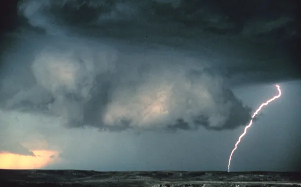
Indianapolis residents should prepare for a high-impact start to Wednesday, March 11, 2026. A line of intense supercells and thunderstorms is projected to move through Central Indiana during the morning commute, with the most severe activity expected between 8:30 AM and 9:00 AM EST. The National Weather Service has issued a Weather Impact Alert, noting that these storms may produce wind gusts as high as 50 MPH and heavy downpours that could lead to localized flooding. Drivers are urged to exercise extreme caution as visibility will be limited and ponding on roadways is likely.
Afternoon: Record Warmth Before the Front
By midday, the initial line of severe weather is expected to transition into scattered showers and occasional thunderstorms. Despite the rain, Indianapolis will experience unseasonably warm temperatures, with highs reaching into the mid-to-upper 60s—potentially approaching record levels for this date. However, the atmosphere will remain blustery. Expect sustained southwesterly winds around 20 MPH, with occasional gusts reaching up to 35 MPH throughout the afternoon hours. While there may be brief breaks in the rain, the sky will remain predominantly overcast.
Evening: The Cold Front Collision
The weather story shifts dramatically during the evening hours as a potent cold front sweeps through the region. As the front passes, the wind will shift to the northwest and intensify. Rain showers may briefly turn into a mix of light flurries late tonight as temperatures plummet. After a daily high of 68°F, the mercury is expected to drop rapidly into the 30s by midnight, eventually settling at a low of approximately 29°F to 31°F by Thursday morning.
Key Warnings and Safety Notices
- Flood Risk: Due to a week of heavy rainfall, the ground is already oversaturated. The additional 1 to 2 inches of rain expected today could trigger flash flooding in low-lying areas.
- Wind Advisory: Blustery conditions will persist all day. Residents should secure loose outdoor furniture and be mindful of debris on the roads.
- Severe Weather Risk: Central Indiana remains under a "slight risk" for severe storms, meaning isolated tornadoes or damaging hail cannot be ruled out during the morning hours.
This active weather pattern marks a volatile period for Indiana Severe Weather Preparedness Week. Residents are encouraged to keep multiple ways to receive weather alerts, as conditions are expected to change rapidly as the cold front moves through.