Stormy Start to a Sunny Sunday: Indianapolis Braces for 50 MPH Gusts
Morning Turbulence: Commuters Face Early Storms
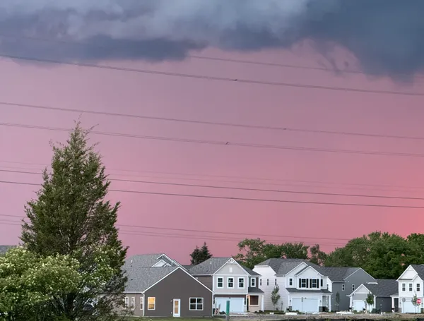
Residents of Indianapolis woke up to a turbulent start this Sunday, March 8, 2026. According to the National Weather Service, a potent line of storms is currently moving through central Indiana, with the heaviest activity expected to persist through approximately 9:00 AM EST. These early morning cells are bringing more than just rain; forecasters have warned of strong wind gusts reaching as high as 50 MPH. Commuters and early risers should be cautious of brief but intense downpours that could lead to localized flooding on low-lying roads. Visibility may be significantly reduced during these bursts of heavy precipitation.
Afternoon Outlook: A Sunny Rebound
Despite the wet start, the atmosphere is expected to stabilize rapidly as the storm front pushes eastward. By late morning, the heavy clouds will begin to break, giving way to much brighter conditions. For the afternoon hours, Indianapolis can expect a dramatic turnaround with mostly sunny skies. Temperatures are forecast to climb to a pleasant high of 63°F (17°C), a welcome relief after the morning’s chill. This warming trend is accompanied by a decrease in wind intensity, though a moderate breeze will likely persist throughout the day, maintaining a fresh spring feel across Marion County.
Kickoff of Severe Weather Preparedness Week
Today also marks the official beginning of Indiana’s Severe Weather Preparedness Week, which runs from March 8 through March 14, 2026. The timing of this morning's storms serves as a timely reminder for Hoosiers to review their emergency protocols. Local officials and the NWS are urging residents to use today’s transition to clear weather to check their disaster kits and ensure they have multiple ways to receive weather alerts. While today's storm risks subside by noon, this week-long campaign is designed to prepare the community for the upcoming tornado season, including a statewide test drill scheduled for later this week on Tuesday morning.
Evening & Overnight Forecast
As the sun sets over the Circle City, the clear conditions will remain, providing a crisp and calm end to the weekend. Evening temperatures will begin a steady descent, eventually bottoming out at a low of 43°F (6°C) overnight. Winds will shift and remain light, making for a quiet night. Looking ahead to Monday, the sunshine is expected to continue with even warmer temperatures on the horizon, but for tonight, a light jacket will be necessary for anyone heading out to enjoy the clear March sky.

Indianapolis 500 race day travel choices: on-site parking sold out, shuttles, bikes and rideshares detailed

Indiana Black Expo announces 2026 Music Heritage Festival outdoor concert lineup for Indianapolis Summer Celebration weekend

Indianapolis Economic Development Committee Convenes Today as City Navigates Major Budget and School Board Shifts