Soggy Skies and Foggy Commutes: Indianapolis Braces for a Rain-Soaked Thursday

Morning: A Treacherous Start to the Day
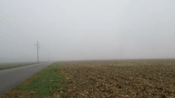
Residents of Indianapolis are waking up to a gray and damp start this Thursday, March 5, 2026. Local meteorologists have issued a Weather Impact Alert Day as dense fog and heavy rain move into Central Indiana. Visibility is significantly reduced across the metro area, especially in low-lying spots and near the White River. Drivers heading out for the morning commute are urged to use low-beam headlights and allow for extra travel time. Scattered rain showers began early this morning and are expected to persist through the 11:00 AM hour, with temperatures starting in the mid-50s—an unseasonably mild beginning for early March.
Afternoon: Rising Temperatures and Steady Downpours
As we move into the afternoon, the scattered showers will transition into a more consistent, steady rain. Despite the gloomy skies, Indianapolis will see a surprising spike in mercury. We are tracking a projected high of 66°F, which is nearly 20 degrees above the typical average for this time of year. This warmth is being driven by a slow-moving frontal boundary stalling over the region. Between 1:00 PM and 4:00 PM, expect the heaviest rainfall totals, with some areas likely to see embedded downpours. Total precipitation for the day is estimated at nearly three-quarters of an inch, which could lead to ponding on local roadways and in urban drainage areas.
Evening: Continued Humidity and Flood Concerns
The rain is not expected to let up as we head into the evening hours. While the steadiest rain may taper off into lighter showers after 6:00 PM, the atmosphere remains incredibly saturated with humidity levels hovering near 98%. This will likely lead to the return of patchy fog across the city as evening temperatures hold steady in the mid-to-upper 50s. Winds will remain relatively light, coming out of the southeast at approximately 10 mph, but the primary concern remains the moisture on the ground and in the air.
Alerts and Warnings to Keep in Mind
The National Weather Service has maintained a Flood Watch for Marion County and surrounding areas, currently set to expire at noon today, though officials continue to monitor rising water levels in creeks and streams. Additionally, a Dense Fog Advisory remains a factor for those navigating the city's interstates. Looking ahead to tonight, the rain will likely continue with a low of 54°F. There is also a developing chance of thunderstorms after 4:00 AM Friday morning as a more volatile system approaches from the west, potentially setting the stage for an even wetter end to the work week.

Circle City Briefing: Tournament Heat Meets a Foggy Commute
Dense Fog and Major Roadworks Slow Thursday Morning Commute in Indianapolis
Live Southern Hits and Electric Beats: What's On in Indy Today